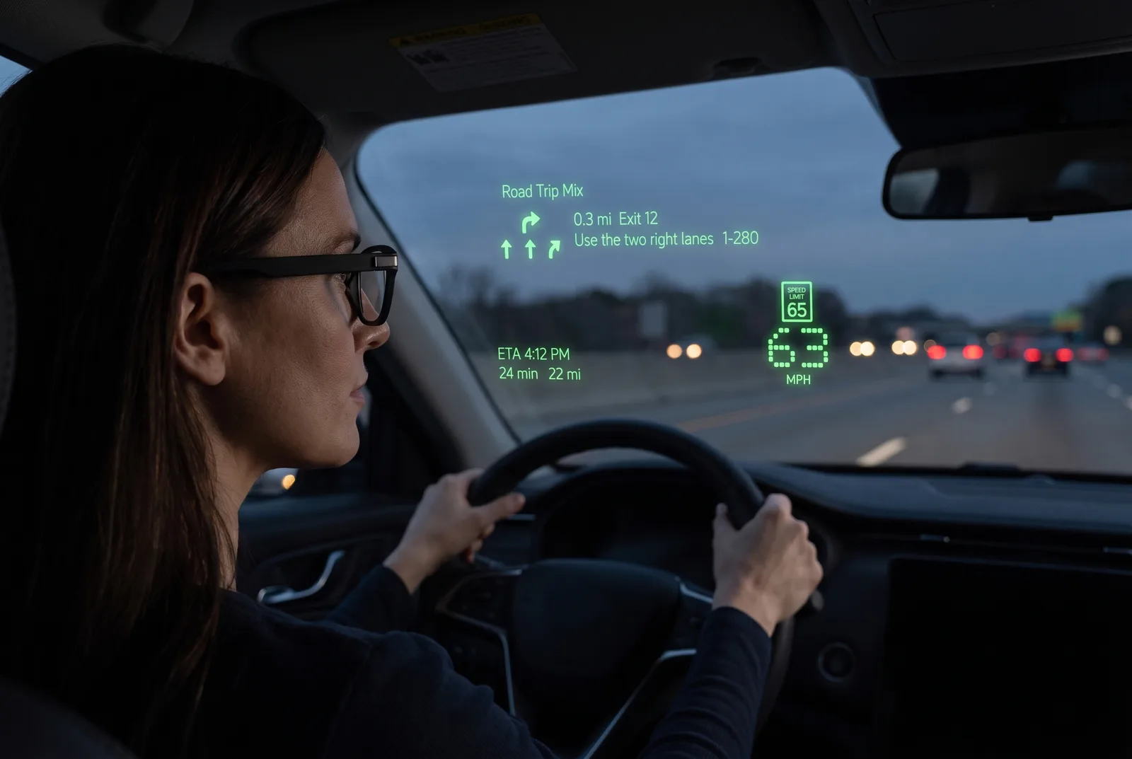
Your next turn, in your line of sight.
Turn-by-turn guidance, your speed beside the posted limit, your ETA and road alerts, on the lens of your Even Realities G2. Your eyes stay on the road.
Free on open data, with no account and no ads. Pro is $4.99 a month for live traffic and commercial speed limits, and the first three days are on us.
Six ways out of the door.
Every layout hugs the edges, so the middle of the lens stays clear. You are looking at the road through it.
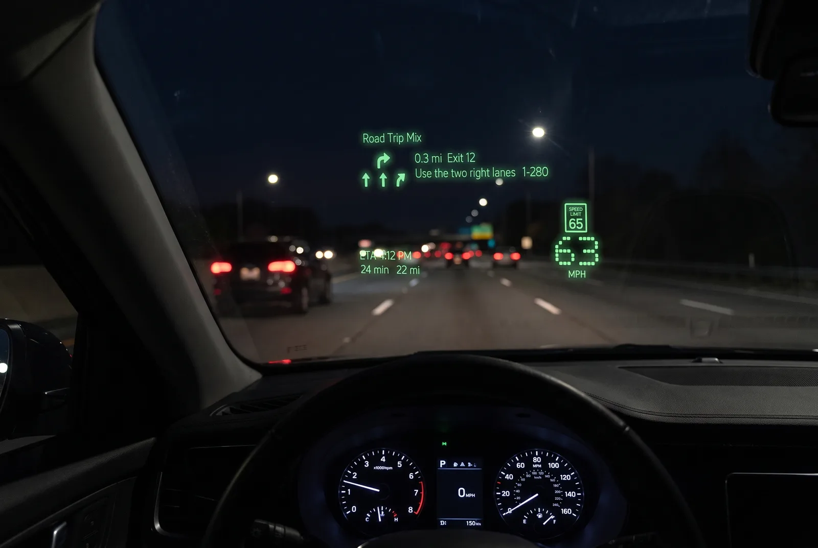
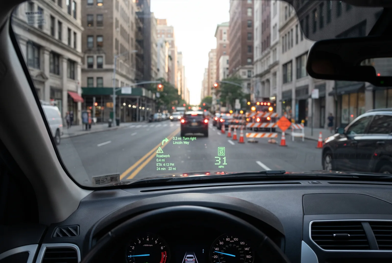
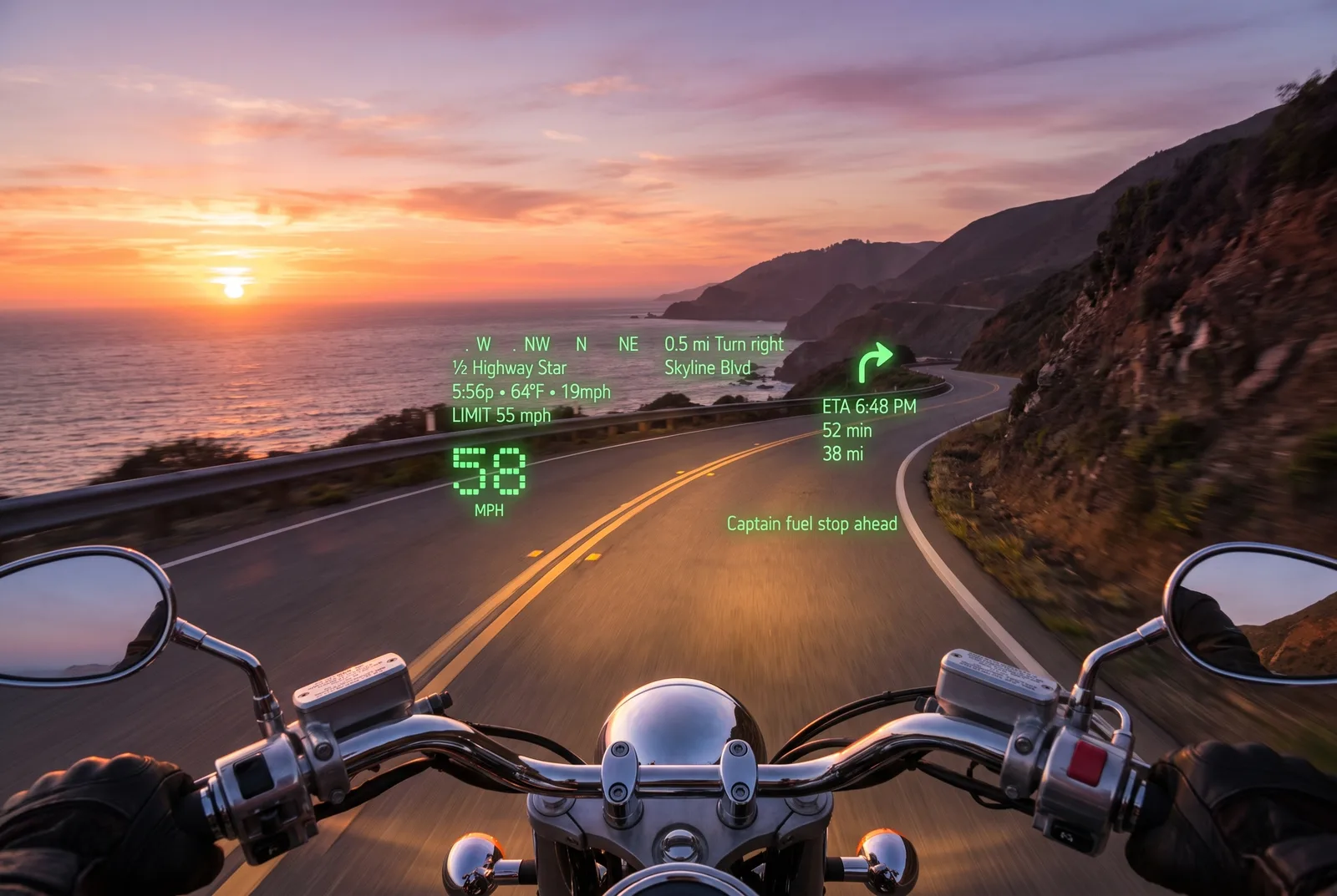
Every scene is seen through the glasses; the green display is Navigaze’s own lens capture.
Drive
Exit 12 in three tenths of a mile, the two right lanes, the posted 65 beside your own 63, and the ETA. Nothing in the middle of the lens.
A report ahead
Roadwork in four tenths of a mile has dropped into the empty space. Live reports like that arrive with Pro, or with your own key.
Motorcycle
A compass ribbon, the posted 55 beside your 58, Skyline Blvd in half a mile, and a line from the group ride: fuel stop ahead. Built with a rider.
Bike
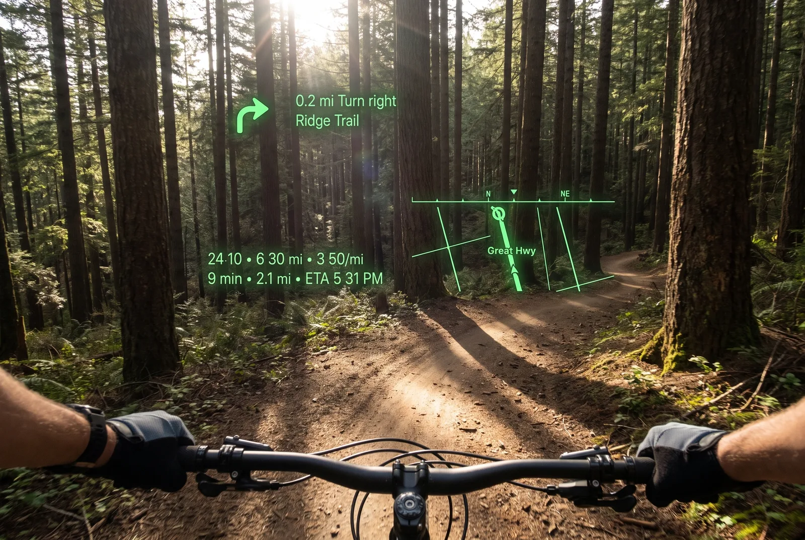
Ridge Trail in two tenths of a mile, your time, distance and pace so far, a mini-map with your heading, and the ride logged as a workout if you want it.
Walk
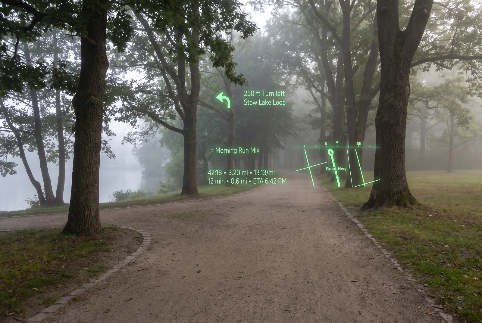
Stow Lake Loop turns left in 250 feet. The walk so far sits under it, tracked if you ask it to be.
Transit
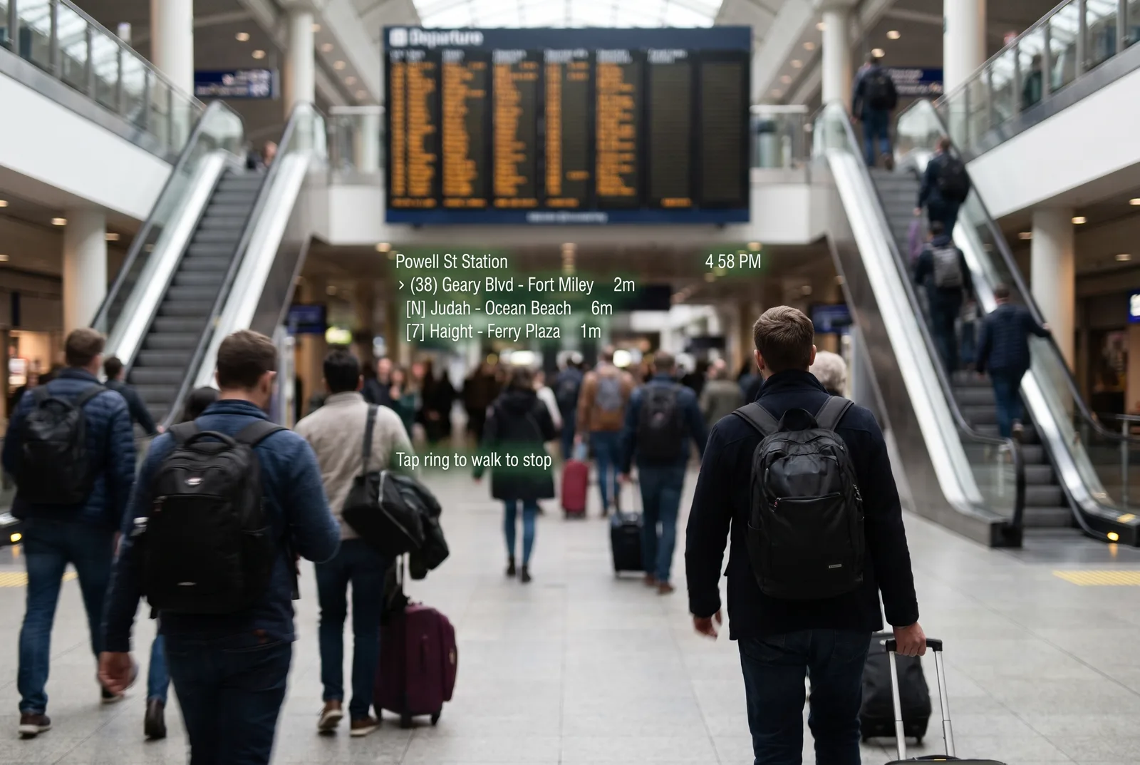
The next three departures from Powell St, soonest first. One ring tap walks you to the stop. Shared bikes and scooters sit beside the stops on Pro.
One app, six shapes.
Pick the mode for the trip and the whole display changes with it: the layout, the routing and what gets a spoken warning.
Your speed, beside the posted one.
Both are large enough to read in a glance, and Navigaze warns you when you cross the limit.
Cameras, hazards, jams, closures.
Camera locations published by public agencies and open-data programmes across the US, Canada, the UK, Australia, Hong Kong and Singapore, 35 feeds, plus a live layer of reports from everyone else using Navigaze. Passengers can report and confirm in one tap.
- Speed cameras
- Red-light cameras
- Collisions
- Hazards
- Road closures
- Traffic jams
- Weather warnings
Take the bus. Or take the bike.
Transit mode shows nearby departures and walking legs, and pins shared bikes and scooters next to the stops: the operator, how many are left, how many docks are free at the other end. Tap Got it and Navigaze switches to Bike mode and re-routes to the same place.
1,028 shared bike and scooter systems from 362 operators in 47 countries, read from the operators’ own open feeds. The full list, and where it does not work.
Free is the whole navigator.
Pro pays for the commercial data behind it, live traffic and speed limits from commercial road data, not a feature you were locked out of. Rather not subscribe? Navigaze takes your own API key instead, in Settings.
Free
$0on open data, no account
- All six modes
- Turn-by-turn routing and address search
- Transit departures
- Community alerts and 35 public camera feeds
- Voice search with an offline model, or your own key
Pro
$4.17a month billed yearly at $49.99, which saves 17%. Or $4.99 month to month.
- Traffic-aware routing and real ETAs
- Speed limits from commercial road data
- Live community reports: jams, hazards, closures
- Shared bikes and scooters in Transit mode
- Cloud voice search, no key to paste, and cloud backup of your places and settings
Your first three days are on us. Cancel any time in PayPal. Full refund within 14 days of your first charge. Start it in the app.
What it will not do.
Ask you to sign up
There is no account and no profile. Your places, routes, workouts and settings live on the phone; community reports carry a random ID, not your name. What leaves the phone, and why.
Sell your data
Searches and speed-limit lookups pass through our server to reach map providers. Pro backs up your saved places so you can restore them; switch it off any time. No ads, no third-party trackers, nothing sold.
Drive for you
It reads the road out to you; the judgement stays yours. Some places restrict head-up displays or alert features while driving. Navigaze tells you, and you must follow local law.